Summarise this page 13 key points · 1 minute
- The 10 at a glanceThe ten trails run from 2.5 km to 14 km, graded 1 to 3, across Troodos, Madari, the Akamas and Cape Greco.
- 1. Artemis trail (Mount Olympos)Artemis is the highest nature trail in Cyprus, a 7 km grade 1 loop of 2.5 to 3 hours past 500-year-old black pines.
- 2. Atalante trail (Mount Olympos)Atalante is a 14 km grade 2 walk of 4 to 5 hours from Troodos Square, passing an 800-year-old juniper and an old chrome mine.
- 3. Kalidonia trail (Caledonia waterfall)Kalidonia is a 3 km grade 3 riverside trail of about 1.5 hours to the waterfall, needing a steady footing on uneven ground.
- 4. Persephone trail (Troodos Square)Persephone is an easy 3 km, one-hour walk from Troodos Square with pine forest and panoramic southern views.
- 5. Mnimata ton PiskoponMnimata ton Piskopon is an 8 km grade 3 cliffside trail of about 3 hours, passing the UNESCO church of Agios Nikolaos tis Stegis.
- 6. Stavros tou Agiasmati – Panagia tou ArakaThis 7 km grade 3 trail links two UNESCO painted churches in about 3 hours, with a steep start and no dogs allowed.
- 7. Teisia tis Madaris (Madari ridge)Teisia tis Madaris is a grade 3 loop of about 1.5 hours below the Madari fire lookout, with cliffs and views over Mesaoria and Morfou Bay.
- 8. Aphrodite trail (Akamas)The Aphrodite trail is 7.5 km, grade 3 and about 3.5 hours from the Baths of Aphrodite, with panoramic sea views.
- 9. Smigies trail (Akamas)Smigies offers a 2.5 km or 6 km grade 2 loop overlooking Lara Bay, so mixed-ability groups can choose the length on the day.
- 10. Sea Caves – Agioi Anargyroi (Cape Greco)This easy 4 km coastal walk of about 1.5 hours links the Ayia Napa sea caves with Agioi Anargyroi church.
- What about Avakas Gorge?Avakas Gorge trail has been closed since 6 December 2025 and remained closed until further notice in May 2026, so check before visiting.
- What should you know before you hike?Stay on the trail, light no fires and take litter home; call 1407 for forest fires and 112 or 199 for emergencies.
Quick answer
The best hiking trails in Cyprus are mostly official nature trails in the Troodos Mountains, the Madari ridge, the Akamas Peninsula and Cape Greco. Top picks include the easy 7 km Artemis loop near the summit of Mount Olympos, the 14 km Atalante circuit, the 3 km Kalidonia waterfall trail, the 7 km route linking two UNESCO-listed churches near Lagoudera and the 4 km Sea Caves trail at Cape Greco. Official trails are graded from 1 (easy) to 3 (difficult).
- The Artemis trail is the highest nature trail in Cyprus, reaching 1,850 m, and passes two black pines around 500 years old.
- The Atalante circuit passes an 800-year-old juniper and the entrance to a chrome mine that has been inactive since 1982.
- The Stavros tou Agiasmati – Panagia tou Araka trail links two UNESCO World Heritage churches, from 1494 and 1192.
- Official trails are graded 1 (easy), 2 (average) or 3 (difficult) on the Visit Cyprus hiking map.
- The Avakas Gorge trail has been closed by the Forestry Department since 6 December 2025 until further notice.
We picked ten official nature trails across the main hiking areas of Cyprus, using the length, grade (1 easy, 2 average, 3 difficult) and walking time published by the Deputy Ministry of Tourism and the Department of Forests. For the full picture, see our hiking routes hub.
The 10 at a glance
| # | Trail | Area | Length | Grade (1–3) | Walking time |
|---|---|---|---|---|---|
| 1 | Artemis | Troodos (Mount Olympos) | 7 km loop | 1 (easy) | 2.5–3 hrs |
| 2 | Atalante | Troodos (Mount Olympos) | 14 km | 2 (average) | 4–5 hrs |
| 3 | Kalidonia | Troodos to Pano Platres | 3 km linear | 3 (difficult) | 1.5 hrs |
| 4 | Persephone | Troodos Square | 3 km | 1 (easy) | 1 hr |
| 5 | Mnimata ton Piskopon | Troodos (Kampos tou Livadiou) | 8 km | 3 (difficult) | 3 hrs |
| 6 | Stavros tou Agiasmati – Panagia tou Araka | Lagoudera area | 7 km linear | 3 | 3 hrs |
| 7 | Teisia tis Madaris | Madari ridge | 3–3.5 km loop | 3 (difficult) | 1.5 hrs |
| 8 | Aphrodite | Akamas | 7.5 km | 3 (difficult) | 3.5 hrs |
| 9 | Smigies | Akamas | 2.5 km or 6 km | 2 (average) | 1–2 hrs |
| 10 | Sea Caves – Agioi Anargyroi | Cape Greco | 4 km | 1 (easy) | 1.5 hrs |
1. Artemis trail (Mount Olympos)
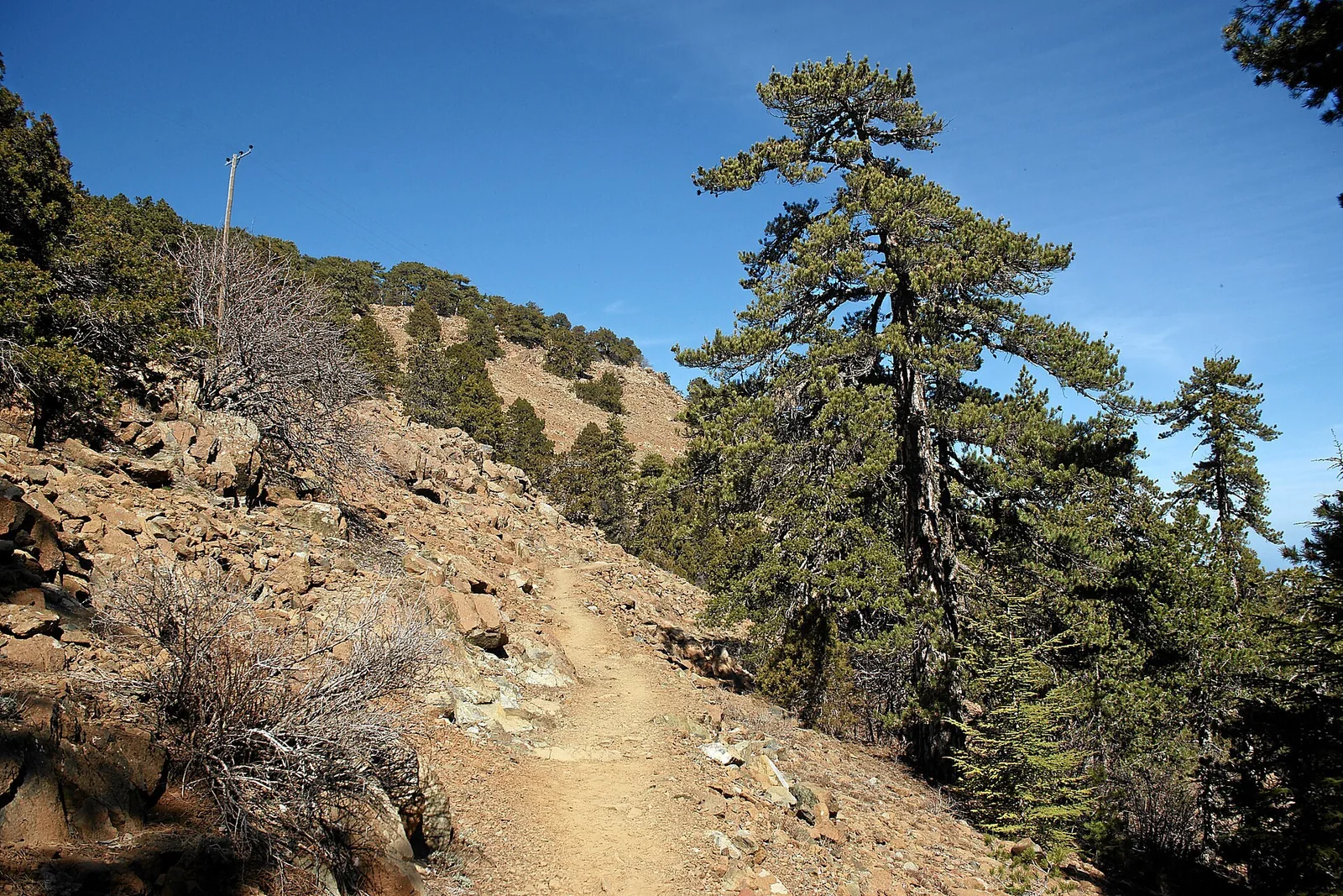
What it is: A circular trail that loops around the top of Mount Olympos (Chionistra) inside Troodos National Forest Park.
Why it's on the list: It is the highest nature trail in Cyprus. It passes through black pine forest, two black pines thought to be around 500 years old, and the ruins of makeshift fortifications built by Venetian generals in the late 1500s.
Where: The start is about 300 m along the Chionistra road from where it meets the Troodos–Prodromos road.
Practical details: 7 km, grade 1, about 2.5 to 3 hours. It starts and finishes at 1,835 m and peaks at 1,850 m. Read our full Artemis trail guide.
Who it suits: Walkers who want an easy grade with high-mountain scenery.
2. Atalante trail (Mount Olympos)
What it is: A longer route from Troodos Square that circles Mount Olympos through black pine forest.
Why it's on the list: Along the way you pass an 800-year-old juniper and the entrance to a chrome mine tunnel that has been inactive since 1982.
Practical details: 14 km, grade 2, 4 to 5 hours. After about 9 km the trail crosses a road, followed by a 200 m dirt section. It can be combined with the Artemis trail.
Who it suits: Hikers with the stamina for a half-day walk at an average grade.
3. Kalidonia trail (Caledonia waterfall)
What it is: A linear trail through dense forest along the Kryos Potamos (Cold River), which has running water all year round.
Why it's on the list: It leads to the Kalidonia waterfall, through dense forest beside the river.
Where: The upper start is about 350 m off the Troodos Square–Platres road, around 3 km from the square. The lower end is at Psilo Dentro (the "Tall Tree") above Pano Platres.
Practical details: 3 km, grade 3, about 1.5 hours. It drops from 1,571 m at the top to 1,238 m at Psilo Dentro. See our Troodos waterfalls guide.
Who it suits: Walkers who are steady on uneven riverside ground, given the difficult grade.
4. Persephone trail (Troodos Square)
What it is: A short walk that starts 150 m south of Troodos Square, towards the police station.
Why it's on the list: It packs dense black pine forest and panoramic views to the south and south-west into a one-hour outing.
Practical details: 3 km, grade 1, about 1 hour.
Who it suits: Anyone wanting an easy, short mountain walk.
5. Mnimata ton Piskopon
What it is: A cliffside trail that starts on level ground at the Kampos tou Livadiou picnic site on the B9 road and then descends.
Why it's on the list: It runs through black pine forest with views over the Solea Valley, Morfou Bay and Chionistra peak, and passes the UNESCO-listed church of Agios Nikolaos tis Stegis.
Practical details: 8 km, grade 3, about 3 hours.
Who it suits: Experienced walkers interested in combining a hike with the painted churches of Troodos.
6. Stavros tou Agiasmati – Panagia tou Araka
What it is: A linear trail that links two UNESCO World Heritage churches with notable frescoes: Stavros tou Agiasmati (1494) and Panagia tou Araka (1192) in Lagoudera.
Why it's on the list: Few walks combine culture and nature so neatly. The route crosses pine forest, diabase cliffs, orchards and vineyards, with views of Morfou Bay and Mount Olympos. An ancient oak stands at Panagia tou Araka, and most of the surrounding forest is part of the Natura 2000 site "Madari–Papoutsa". The trail is part of the E4 European long-distance path.
Where: It starts at Stavros tou Agiasmati, 8 km from Platanistasa village (about 800 m), and ends at Panagia tou Araka in Lagoudera (about 1,000 m). The highest point is about 1,200 m.
Practical details: 7 km, about 3 hours, grade 3 because of a steep climb at the start and the length. The Forestry Department advises booking ahead if you want a guided visit of Stavros tou Agiasmati church. Dogs are not allowed, and bicycles and motorbikes are prohibited.
Who it suits: Fit walkers who want history along the way.
7. Teisia tis Madaris (Madari ridge)
What it is: A circular trail just below the Madari fire lookout on Adelfoi mountain, reached by vehicle from the Chantria–Polystipos road.
Why it's on the list: It has tall cliffs, geological features and views over the Mesaoria Plain and Morfou Bay, and lies in the Troodos Geopark. The highest point of Adelfoi mountain is 1,613 m, where the fire lookout stands.
Practical details: About 1.5 hours, grade 3. Visit Cyprus gives the length as 3 km on its trail page and 3.5 km on its 2026 hiking map. For a full day, the 13 km Madari nature trail (5.5 hours, grade 3) links four linear sections and reaches Adelfi peak.
Who it suits: Hikers looking for ridge views and geology.
8. Aphrodite trail (Akamas)
What it is: A route in the protected Akamas Peninsula that starts at Loutra tis Afroditis (the Baths of Aphrodite).
Why it's on the list: It offers panoramic views, the medieval Queen's Tower (Pyrgos tis Rigainas), the Kefalovrysia fountain and botanical gardens at the start. The neighbouring Adonis trail (also 7.5 km, grade 3, 3.5 hours) leaves from the same place and passes a 500-year-old oak.
Practical details: 7.5 km, grade 3, about 3.5 hours. Our guides to the Aphrodite trail and the Adonis trail have more detail.
Who it suits: Walkers who want sea views and a challenge.
9. Smigies trail (Akamas)
What it is: Two loop options from the Smigies picnic site in the Akamas.
Why it's on the list: Both routes look out over Lara Bay, Chrysochou Bay and the Paphos forest. The longer route adds old mines, abandoned kilns and denser forest, and the trail includes the Piana Ridge fire lookout.
Practical details: Short route 2.5 km (about 1 hour) or long route 6 km (about 2 hours), both grade 2.
Who it suits: Groups with mixed abilities, since you can choose the length on the day.
10. Sea Caves – Agioi Anargyroi (Cape Greco)
What it is: A coastal trail over rocky ground and low shrubs in Cape Greco National Forest Park, in Famagusta (Ammochostos) district.
Why it's on the list: It passes the Ayia Napa sea caves and the Kamara tou Koraka natural arch, and ends at the church and sea cave of Agioi Anargyroi. Wild orchids flower in winter and spring.
Practical details: 4 km, grade 1, about 1.5 hours. You can start at the sea caves or at Agioi Anargyroi church. See our Cape Greco guide.
Who it suits: Families and anyone looking for an easy coastal walk.
What about Avakas Gorge?
Avakas Gorge in the Akamas is not on our list for now: the Forestry Department closed the trail on 6 December 2025 because of increased water flow, slippery ground and the risk of falling rocks. In May 2026 it said the trail remains closed until further notice and that anyone entering does so at their own risk. Check the latest position before you plan a visit; our Akamas and Avakas guide has the background.
What should you know before you hike?
The Forestry Department asks walkers to stay on the trail, not to cut plants or carve tree bark, not to light fires in or near the forest, to take litter home or use the bins, and to respect wildlife (the blunt-nosed viper is venomous). For forest fires call 1407 (24 hours); for emergencies call 112 or 199.
The Department of Forests maintains nature trails inside State Forests. Trails outside State Forests, such as the Millomeris waterfall trail in Pano Platres, are looked after by local authorities.
Related guides
- The E4 long-distance trail in Cyprus
- 10 best waterfalls and nature spots in Cyprus
- 10 best day trips from Limassol
Recommended for this guide
Contains affiliate links GetYourGuide
Frequently asked questions
What is the easiest hiking trail in Cyprus?
Several official trails are graded 1 (easy), including the 7 km Artemis loop near Mount Olympos, the 3 km Persephone trail from Troodos Square and the 4 km Sea Caves – Agioi Anargyroi trail at Cape Greco.
What is the highest hiking trail in Cyprus?
The Artemis trail around the top of Mount Olympos (Chionistra). It starts and ends at 1,835 m and reaches 1,850 m, making it the highest nature trail on the island.
Is Avakas Gorge open in 2026?
No. The Forestry Department closed the Avakas Gorge trail on 6 December 2025 because of increased water flow, slippery ground and falling rocks, and said in May 2026 that it stays closed until further notice. Anyone who enters does so at their own risk.
Can I take my dog on Cyprus nature trails?
Not on every trail. The Forestry Department leaflet for the Stavros tou Agiasmati – Panagia tou Araka trail says dogs are not allowed and bicycles and motorbikes are prohibited, so check the rules for each trail before you go.
Who looks after hiking trails in Cyprus?
The Department of Forests maintains the nature trails inside State Forests. Trails outside State Forests are looked after by local authorities, so contact the local community or municipality about those.
What number do I call if I see a forest fire?
The Forestry Department lists 1407 (24 hours) for forest fires and 112 or 199 for emergencies.
Useful links
- Visit Cyprus – Hiking Map – Nature Trails
- Visit Cyprus – Artemis (Circular), Troodos Forest Nature Trail
- Visit Cyprus – Kalidonia (Linear), Troodos Forest Nature Trail
- Visit Cyprus – Teisia tis Madaris (Circular), Adelfoi Forest Nature Trail
- Nature Trail Stavros tou Agiasmati – Panagia tou Araka (leaflet) – Department of Forests
- Nature trails outside State Forests – Department of Forests
Sources (7)
- Hiking Map – Nature Trails (2026) – Deputy Ministry of Tourism (visitcyprus.com)
- Artemis (Circular), Troodos Forest Nature Trail – Deputy Ministry of Tourism (visitcyprus.com)
- Kalidonia (Linear), Troodos Forest Nature Trail – Deputy Ministry of Tourism (visitcyprus.com)
- Teisia tis Madaris (Circular), Adelfoi Forest Nature Trail – Deputy Ministry of Tourism (visitcyprus.com)
- Nature Trail Stavros tou Agiasmati – Panagia tou Araka (leaflet) – Department of Forests
- Nature trails outside State Forests – Department of Forests
- Politis – Avakas Gorge remains closed as visitors continue to ignore warnings (6 May 2026)